
- Haber Akışı
- KEŞFEDIN
- Sayfalar
- Etkinlikler
- Bloglar
-
 Hakkımızda
Integration, Data Security, and Reporting Efficiency Within Modern Fisheries Software
Introduction: Software as the Central Nervous System of Fisheries Research
The evolution of fisheries science over the past three decades has been fundamentally shaped not merely by hardware advances in tagging technology and detection systems, but equally by the sophisticated software platforms that collect, manage, analyze, and disseminate the resulting data. Modern fisheries software has evolved from simple spreadsheet-based data loggers into comprehensive enterprise-class information systems that integrate data streams from multiple sources, enforce rigorous data quality standards, provide advanced analytical capabilities, ensure regulatory compliance, and deliver actionable intelligence to managers and stakeholders.
The contemporary fisheries software landscape is characterized by several defining trends: migration from desktop applications to cloud-based platforms, integration of real-time data streams from automated monitoring infrastructure, implementation of enterprise-grade security protocols protecting sensitive ecological data, incorporation of advanced analytics and machine learning capabilities, and emphasis on data interoperability enabling multi-agency collaboration across complex governance structures.
For research programs managing millions of detection records, thousands of tagged individuals, and collaborations spanning multiple institutions, the selection and implementation of appropriate software infrastructure is as critical as any hardware procurement decision. Poor software choices lead to data silos, quality control failures, analytical bottlenecks, and ultimately, compromised scientific conclusions and management decisions.
This article examines the three pillars of modern fisheries software excellence: integration capabilities that unify diverse data sources, security architectures that protect data integrity and confidentiality, and reporting systems that transform raw data into actionable intelligence.
Integration Architecture: Unifying Complex Data Ecosystems
The Multi-Source Data Challenge
Contemporary fisheries programs generate data from diverse sources requiring integration into coherent analytical frameworks:
Electronic tagging systems:
-
PIT tag detection records from fixed antenna arrays and handheld readers
-
Acoustic telemetry detections from underwater receiver networks
-
Satellite tag transmissions from large pelagic species
-
Radio telemetry locations from terrestrial and avian species
Biological sampling data:
-
Morphometric measurements (length, weight, condition factors)
-
Age determination (scale analysis, otolith readings)
-
Genetic samples and DNA sequence data
-
Disease and pathogen screening results
-
Tissue contaminant concentrations
Environmental monitoring:
-
Water quality parameters (temperature, dissolved oxygen, pH, conductivity)
-
Hydrological data (flow rates, water levels, turbidity)
-
Weather conditions (precipitation, air temperature, barometric pressure)
-
Habitat characteristics (substrate composition, vegetation cover, channel morphology)
Operational data:
-
Hatchery production records
-
Harvest statistics (commercial and recreational fisheries)
-
Stocking events and supplementation programs
-
Regulatory actions (closures, escapement targets, allocation adjustments)
Spatial data:
-
GPS coordinates and georeferenced locations
-
Geographic information system (GIS) layers (watersheds, jurisdictions, habitat classifications)
-
Remote sensing imagery (aerial photography, LiDAR, multispectral satellite data)
Effective fisheries software must seamlessly integrate these heterogeneous data types, maintaining data provenance (documenting source and processing history), enforcing referential integrity (ensuring related data across tables remain consistent), and providing unified query interfaces enabling cross-domain analysis.
Database Architecture and Standards
Modern fisheries software is built on relational database management systems (RDBMS) that organize data into structured tables with defined relationships. Leading platforms utilize:
PostgreSQL — Open-source RDBMS widely adopted in government and academic settings due to zero licensing cost, robust spatial data support (PostGIS extension), and advanced features like JSON data types, full-text search, and sophisticated query optimization.
Microsoft SQL Server — Commercial RDBMS common in enterprise environments, offering tight integration with Microsoft Azure cloud services, comprehensive business intelligence tools, and extensive third-party support ecosystem.
Oracle Database — Enterprise-class RDBMS used in large-scale government systems requiring maximum scalability, supporting millions of concurrent transactions and petabyte-scale data volumes.
MySQL/MariaDB — Lightweight open-source options suitable for smaller programs or embedded applications.
Modern systems implement normalized database schemas following at minimum Third Normal Form (3NF) principles, eliminating data redundancy and ensuring consistency. A typical fisheries database schema includes tables for:
-
Tag inventory — Complete registry of all tags deployed, with unique identifiers, manufacturing details, and deployment history
-
Tagging events — Records of tag implantation with date, location, species, biometrics, and personnel
-
Detection events — Individual detection records from automated and manual readers
-
Recapture events — Physical recaptures with updated measurements and samples
-
Sites/locations — Standardized geographic location registry with coordinates and metadata
-
Species taxonomy — Authoritative species list with scientific nomenclature and common names
-
Personnel — User accounts, roles, and contact information
-
Equipment — Reader inventory, calibration records, and maintenance history
API-Driven Integration
Contemporary software architectures expose Application Programming Interfaces (APIs) enabling programmatic data exchange between systems. Two dominant API paradigms exist:
REST APIs (Representational State Transfer): Lightweight, web-based interfaces using standard HTTP methods (GET, POST, PUT, DELETE) to retrieve and manipulate data. REST APIs typically exchange data in JSON (JavaScript Object Notation) format, enabling easy integration with web applications, mobile apps, and scripting environments (Python, R).
Example REST API call retrieving detections for a specific tag:
text
GET https://api.fisheries-database.org/v1/detections?tag_code=3DD.003B6A4E2F&start_date=2024-01-01
GraphQL APIs: More sophisticated query language enabling clients to request precisely the data structure needed, reducing over-fetching and minimizing network traffic. GraphQL is increasingly adopted in modern platforms, particularly those with complex, interconnected data models.
APIs enable:
-
Automated data uploads from field readers directly to central databases
-
Cross-agency data sharing between collaborating organizations
-
Third-party tool integration (statistical software, GIS platforms, reporting tools)
-
Mobile application development providing field access to central databases
VodaIQ provides comprehensive API-driven integration capabilities, enabling seamless connectivity between field hardware, data management platforms, and analytical tools.
Real-Time Data Streaming
Traditional fisheries data management involved batch processing — data collected in field devices over days or weeks, then manually downloaded and uploaded to central databases during periodic office sessions. Modern systems implement real-time or near-real-time data streaming where detection events flow continuously from field infrastructure to central databases via:
Cellular connectivity: Fixed detection stations equipped with 4G/5G modems transmit detection records within seconds of occurrence
Satellite links: Remote installations beyond cellular coverage use Iridium or Globalstar satellite transceivers providing data transmission every 15 minutes to several hours
Wi-Fi synchronization: Handheld readers automatically upload data when brought within range of configured Wi-Fi networks
Real-time streaming enables:
-
Adaptive management — Immediate awareness of population arrivals triggering operational responses (opening/closing fisheries, adjusting hatchery operations)
-
Equipment monitoring — Rapid detection of system failures requiring maintenance intervention
-
Data validation — Immediate flagging of anomalous detections for verification
-
Stakeholder engagement — Public-facing dashboards showing current migration status
The Columbia River DART (Data Access in Real Time) system exemplifies this approach, providing public access to fish passage data updated multiple times daily during migration seasons.
Interoperability Standards
To facilitate data exchange across different software platforms and agencies, the fisheries informatics community has developed standardized data formats and vocabularies:
Darwin Core Standard: Originally developed for biodiversity informatics, Darwin Core provides a standardized vocabulary for species occurrence data, including taxonomy, location, date/time, and observation methods. Adoption of Darwin Core enables fisheries data to integrate seamlessly with global biodiversity databases.
Ecological Metadata Language (EML): XML-based standard for documenting datasets with comprehensive metadata (who collected the data, when, where, using what methods, under what license). EML ensures long-term data interpretability and enables discovery through metadata catalogs.
ISO 19115 / 19139: International standards for geospatial metadata, essential for fisheries datasets with strong spatial components.
Standard taxonomic authorities: Systems reference authoritative taxonomic databases like the Integrated Taxonomic Information System (ITIS) or World Register of Marine Species (WoRMS) to ensure consistent species nomenclature across institutions.
Data Warehouse and Business Intelligence Integration
Large-scale programs increasingly implement data warehouse architectures that aggregate data from multiple operational systems into unified analytical repositories optimized for complex queries and reporting. Data warehouses typically employ:
ETL processes (Extract, Transform, Load): Automated workflows that periodically extract data from operational databases, transform it into standardized formats and dimensional models, and load it into the warehouse.
Star or snowflake schemas: Denormalized database designs optimizing query performance for analytical workloads, organizing data into fact tables (measurements/observations) and dimension tables (descriptive attributes).
OLAP cubes (Online Analytical Processing): Pre-calculated aggregations enabling rapid multidimensional analysis (e.g., "show me survival rates by species, release site, and release year").
Business intelligence platforms like Microsoft Power BI, Tableau, Qlik Sense, or open-source Apache Superset connect to data warehouses, providing drag-and-drop interfaces for creating visualizations, dashboards, and reports without programming expertise.
Data Security: Protecting Sensitive Ecological Information
The Multi-Dimensional Security Challenge
Fisheries data requires protection across several dimensions:
Data confidentiality: Preventing unauthorized access to sensitive information including:
-
Precise locations of endangered species (valuable to poachers)
-
Proprietary hatchery broodstock genetics
-
Pre-publication research data
-
Personally identifiable information of personnel and collaborators
Data integrity: Ensuring data cannot be maliciously or accidentally altered, maintaining complete audit trails of all modifications
Data availability: Ensuring authorized users can access systems when needed, protecting against denial-of-service attacks and infrastructure failures
Regulatory compliance: Meeting legal requirements including:
-
HIPAA (if human health data is involved in contaminant studies)
-
FERPA (if student researchers' data is included)
-
State public records laws (balancing transparency with confidentiality)
-
Tribal data sovereignty (respecting indigenous nations' authority over data from their territories)
Authentication and Authorization
Modern fisheries software implements multi-layered authentication and authorization systems:
User authentication methods:
-
Username/password with complexity requirements (minimum length, character diversity, expiration policies)
-
Multi-factor authentication (MFA) requiring secondary verification (SMS codes, authenticator apps, hardware tokens)
-
Single Sign-On (SSO) integration with institutional identity providers (Active Directory, LDAP, SAML, OAuth)
-
Certificate-based authentication for automated system-to-system communication
Role-based access control (RBAC): Users are assigned roles defining their permitted actions:
-
Public viewer: Read-only access to aggregated, de-identified data
-
Field technician: Data entry and editing for assigned projects
-
Principal investigator: Full data access and analysis for research projects
-
Data manager: Administrative control over data quality and validation
-
System administrator: Full system configuration and user management
Fine-grained permissions: Modern systems implement permissions at multiple levels:
-
Database-level: Control which databases/schemas users can access
-
Table-level: Restrict access to specific data tables
-
Row-level: Users see only data for their assigned sites/projects
-
Column-level: Sensitive fields (e.g., precise GPS coordinates) hidden from certain user classes
Encryption
Data encryption protects information from unauthorized access:
Data at rest encryption: Data stored on disk is encrypted using algorithms like AES-256 (Advanced Encryption Standard), ensuring that if physical storage media is stolen, data remains inaccessible without decryption keys. Modern database systems provide transparent data encryption (TDE) requiring no application code changes.
Data in transit encryption: Network communications use TLS (Transport Layer Security) protocols, encrypting data flowing between users and servers, between application servers and database servers, and between distributed system components. This prevents interception of sensitive data during transmission.
Key management: Encryption is only as strong as the protection of encryption keys. Enterprise systems use Hardware Security Modules (HSMs) or cloud-based key management services (AWS KMS, Azure Key Vault) to generate, store, and rotate encryption keys securely.
Audit Logging and Compliance
Comprehensive audit logging records all system activities:
User activity logging: Recording who accessed what data, when, from what IP address/location, and what actions they performed (view, create, update, delete)
Data modification logging: Before-and-after snapshots of all data changes, creating complete provenance trails enabling:
-
Error detection and correction (identifying when erroneous data was introduced)
-
Security investigation (detecting unauthorized modifications)
-
Regulatory compliance demonstration
Automated anomaly detection: Systems monitor access patterns and flag suspicious activity:
-
Unusual access volumes (user downloading massive data quantities)
-
Access from unexpected locations (login from foreign country)
-
After-hours access without justification
-
Repeated failed authentication attempts
Audit logs are append-only (cannot be altered or deleted, even by administrators) and stored in write-once-read-many (WORM) storage systems or blockchain-based immutable ledgers, ensuring their evidentiary integrity.
Sensitive Location Data Protection
A particular challenge in wildlife tracking is balancing scientific transparency with protection of vulnerable species. Strategies include:
Spatial generalization: Publicly shared data shows only coarse location information (e.g., watershed-level rather than precise GPS coordinates)
Temporal delay: Precise locations are embargoed for defined periods (6 months to 2 years), then released after the temporal window of poaching vulnerability passes
Trusted researcher agreements: Precise data available to vetted researchers who sign legal agreements restricting use and prohibiting redistribution
Differential privacy: Advanced mathematical techniques adding controlled statistical noise to datasets, enabling useful analyses while protecting individual location privacy
Backup and Disaster Recovery
Data protection includes robust backup and recovery capabilities:
Backup strategies:
-
Automated daily backups of complete databases
-
Incremental backups every 1–6 hours capturing changes since last full backup
-
Geographic redundancy with backups stored in physically separate locations
-
Cloud-based backup to services like AWS S3, Azure Blob Storage, or Google Cloud Storage
Disaster recovery metrics:
-
Recovery Point Objective (RPO): Maximum acceptable data loss measured in time (e.g., 1 hour RPO means at most 1 hour of recent data could be lost)
-
Recovery Time Objective (RTO): Maximum acceptable downtime (e.g., 4 hour RTO means system must be restored within 4 hours of failure)
Critical fisheries management systems typically target RPO of 1 hour and RTO of 4–8 hours, requiring sophisticated backup infrastructure and tested recovery procedures.
Backup validation: Regular testing ensures backups are functional — actually restoring test databases from backups on quarterly schedules, verifying data integrity and completeness.
Reporting Efficiency: From Data to Decisions
The Reporting Hierarchy
Effective fisheries software supports reporting at multiple levels:
Operational reports: Daily/weekly summaries of current activities:
-
Detection counts by site and species
-
Equipment status and maintenance alerts
-
Field crew activity logs
-
Data quality metrics (validation failure rates, pending reviews)
Tactical reports: Monthly/seasonal analyses informing near-term management:
-
Migration timing distributions
-
Passage efficiency at barriers
-
Survival estimates for recent cohorts
-
Harvest rates and escapement progress
Strategic reports: Annual/multi-year assessments guiding policy:
-
Population trend analyses
-
Hatchery program effectiveness evaluations
-
Climate change impact assessments
-
Regulatory compliance documentation
Stakeholder communications: Public-facing summaries for non-technical audiences:
-
Infographics and visualizations
-
Interactive web dashboards
-
Executive summaries with key findings
-
Press release supporting materials
Automated Report Generation
Modern systems automate routine reporting, eliminating manual data extraction and formatting:
Scheduled report execution: Reports automatically generated on defined schedules (daily at 6 AM, weekly on Mondays, monthly on the 1st) and delivered via email or posted to web portals
Parameterized templates: Report formats defined once, then automatically populated with current data. Parameters allow customization (generate the same report format for different species, sites, or time periods)
Multi-format output: Single report definition can generate multiple output formats:
-
PDF for formal documentation and archival
-
Excel for further manipulation and ad-hoc analysis
-
HTML for web publishing
-
CSV for import into other systems
Natural language generation: Advanced systems use AI to automatically generate narrative text describing patterns in data (e.g., "Chinook salmon passage increased 23% compared to the 10-year average, with peak migration occurring 5 days earlier than historical median")
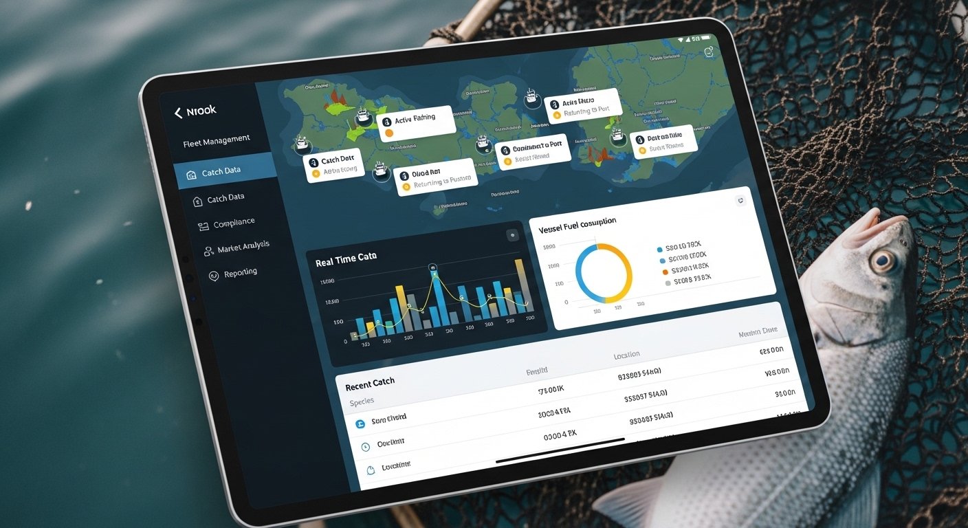
Interactive Dashboards and Data Visualization
Static reports are increasingly supplemented by interactive dashboards enabling users to explore data dynamically:
Real-time monitoring dashboards: Displaying current status of detection networks, with:
-
Maps showing site locations color-coded by detection volume or system status
-
Time-series plots of detection counts over recent hours/days
-
Alert panels highlighting anomalies or failures
-
Equipment health indicators (battery voltage, signal strength, communication status)
Analytical dashboards: Supporting exploratory data analysis:
-
Filters and selectors enabling dynamic data subset selection
-
Drill-down capabilities (clicking on a summary to see underlying details)
-
Interactive visualizations responding to user input
-
Comparative displays (side-by-side comparison of different years, sites, or species)
Executive dashboards: High-level summaries for managers and decision-makers:
-
Key performance indicators (KPIs) with targets and current status
-
Trend indicators (increasing/stable/decreasing)
-
Exception highlighting (metrics outside expected ranges)
-
Minimal detail, maximum clarity
Technologies enabling advanced dashboards include:
D3.js (Data-Driven Documents): JavaScript library for creating highly customized, interactive web-based visualizations
Plotly/Dash: Python framework for building analytical web applications with interactive charts
Shiny (R): Web application framework for R, enabling statisticians to create interactive tools without web development expertise
Commercial platforms: Tableau, Power BI, Qlik providing enterprise-grade business intelligence and visualization
Statistical Analysis Integration
Fisheries software increasingly integrates statistical analysis capabilities directly into data management platforms:
Built-in statistical functions: Common analyses available through user interfaces without programming:
-
Survival estimation (Kaplan-Meier, Cormack-Jolly-Seber models)
-
Growth modeling (von Bertalanffy curves)
-
Population abundance estimation (Peterson, Schnabel, SPAS models)
-
Migration timing analysis (distribution fitting, percentile calculation)
R and Python integration: Open-source statistical programming languages R and Python are embedded within fisheries software platforms:
-
R Shiny servers providing web-based R analytical apps
-
Jupyter notebooks embedded in platforms, combining narrative text, code, visualizations, and results
-
API access enabling R/Python scripts to query databases, run analyses, and write results back
GIS integration: Spatial analysis capabilities through:
-
PostGIS spatial database extensions enabling geographic queries (find all detections within 10 km of a point)
-
QGIS integration connecting open-source desktop GIS to fisheries databases
-
ArcGIS integration for organizations using Esri products
-
Web mapping using Leaflet, Mapbox, or Google Maps APIs
Report Archival and Version Control
Long-term research programs require systematic management of report versions and historical analyses:
Report repositories: Centralized storage of all generated reports with:
-
Metadata (generation date, author, data version, parameters)
-
Permanent archival storage (ensuring reports remain accessible decades later)
-
Search and retrieval interfaces
-
Access control (some reports may be confidential for defined periods)
Data versioning: Documenting which version of the dataset was used for each analysis, enabling:
-
Reproducibility (re-running historical analyses with identical data)
-
Impact assessment (understanding how data corrections affect previous conclusions)
-
Regulatory compliance (demonstrating that reported values accurately reflected available data at reporting time)
Code versioning: Analysis scripts and report generation code managed in version control systems (Git, GitHub, GitLab) ensuring:
-
Complete history of analytical method evolution
-
Ability to revert to previous versions if errors are introduced
-
Collaboration support (multiple analysts contributing to shared code base)
-
Peer review (code changes reviewed before acceptance)
Emerging Trends in Fisheries Software
Cloud-Native Architectures
The fisheries software landscape is rapidly migrating from on-premises servers to cloud-based platforms:
Advantages:
-
Scalability: Computational resources scale automatically with demand
-
Accessibility: Web-based access from any location/device
-
Collaboration: Multiple organizations sharing infrastructure and data
-
Cost efficiency: Pay-per-use pricing eliminating large capital equipment purchases
-
Automatic updates: Continuous software improvements without manual installation
-
Disaster resilience: Cloud providers offer exceptional backup and geographic redundancy
Leading cloud platforms:
-
Amazon Web Services (AWS): Dominant market leader, comprehensive service catalog
-
Microsoft Azure: Strong integration with Microsoft ecosystem, government cloud options
-
Google Cloud Platform (GCP): Advanced machine learning and analytics tools
-
Specialized research clouds: National Science Foundation XSEDE, Department of Energy ESnet
Machine Learning and AI Integration
Artificial intelligence is transforming fisheries data analysis:
Automated species identification: Machine learning models trained on thousands of fish images achieve >95% accuracy in species classification, supporting quality control in high-volume tagging operations
Anomaly detection: AI algorithms identify unusual patterns in detection data (potential equipment malfunctions, data quality issues, or biologically significant events)
Predictive modeling: Machine learning predicts migration timing, survival probabilities, and population responses to environmental conditions with greater accuracy than traditional statistical models
Natural language interfaces: Conversational AI enabling managers to query databases in plain English (e.g., "Show me Chinook survival trends for the last decade") without SQL expertise
Blockchain for Data Integrity
Distributed ledger technology provides tamper-proof recording of critical data:
Use cases:
-
Chain of custody: Documenting sample collection, handling, and analysis with cryptographic proof of integrity
-
Multi-agency data sharing: Organizations contributing data to shared resources with guaranteed provenance
-
Regulatory compliance: Immutable records of harvest reporting, tag deployments, and monitoring data
While still emerging, blockchain implementations are being piloted in fisheries traceability (tracking wild-caught fish from boat to market) with potential application to research data management.
Mobile-First Design
Modern platforms prioritize mobile device compatibility, recognizing that field personnel increasingly use smartphones and tablets:
-
Responsive web design: Interfaces automatically adapt to screen size and orientation
-
Progressive web apps (PWAs): Web applications with offline capability, installable on devices like native apps
-
Native mobile apps: iOS and Android applications for maximum performance and device integration
-
Offline-first architecture: Applications function without connectivity, synchronizing when connection is restored
Conclusion: Software as Strategic Infrastructure
Modern fisheries software represents far more than a data storage solution. It functions as strategic infrastructure that determines an organization's capacity to integrate complex data ecosystems, protect sensitive ecological information, generate actionable intelligence, and ultimately, fulfill the mission of science-based resource management.
The investment in sophisticated software platforms — whether through procurement of commercial systems, development of custom solutions, or participation in shared multi-agency platforms — pays dividends across every dimension of program effectiveness. High-quality software infrastructure reduces data management labor costs, accelerates the timeline from data collection to management decision, improves data quality through systematic validation, enables sophisticated analyses previously impossible, and facilitates the collaboration across agencies and disciplines essential to addressing complex conservation challenges.
As fisheries science continues to generate ever-larger and more complex datasets — from expanding PIT tag networks, proliferating environmental sensors, advancing genetic technologies, and remote sensing platforms — the software systems managing this data tsunami will increasingly determine which organizations thrive and which struggle to extract insight from information overload.